Trip Overview
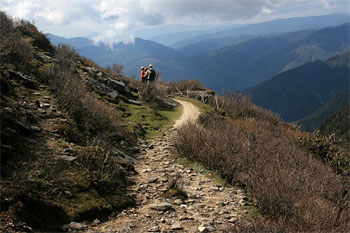
Uttarey Singalila Trek is one of the most famous adventure trekking routes in Sikkim. It encompasses the area southwest of Dzongri and as defined by its name, includes several days of hike traversing the Singalila Ridge, the lesser mountain chain that rises from the northern hills of Darjeeling district and extends to converge with the Kanchenjunga massif.
The Singalila ridge demarcates the western borders of Sikkim and Darjeeling with Nepal. The Uttarey Singalila Trek route traverse through Singalila National Park and Kanchenjunga National Park both of which are the rich habitat of exotic flora and fauna.
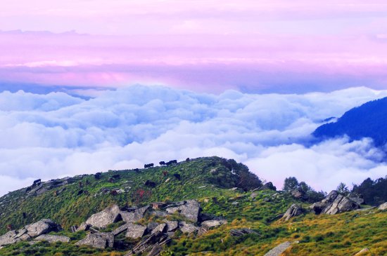
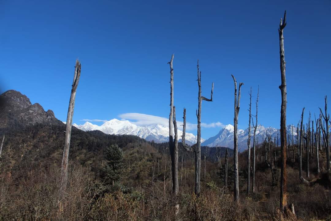
Lush green forest, varieties of rhododendron flowers, alluring alpine valleys, scenic meadows, captivating landscape, panoramic mountain range, and majestic views of the towering snow-capped mountain peaks make this trekking route an ideal adventure destination. Some high-altitude lakes along the trails add more beauty to this Trek.
There are many high-altitude lakes on the Nepal side that are approachable from the main trekking trail. It can be explored with few additional days.
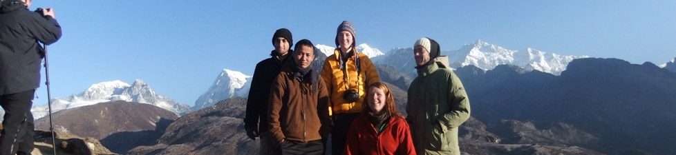
During this trek, you will be able to witness the panoramic views of the majestic mountain range of both the Sikkim and Nepal sides. Mt. Everest, Mt. Lhotse, Mt. Makalu of Nepal aside, and Mt. Kanchenjunga, Mt. Pandim, and several other peaks of Sikkim side are seen from Dafey Bhir viewpoint.
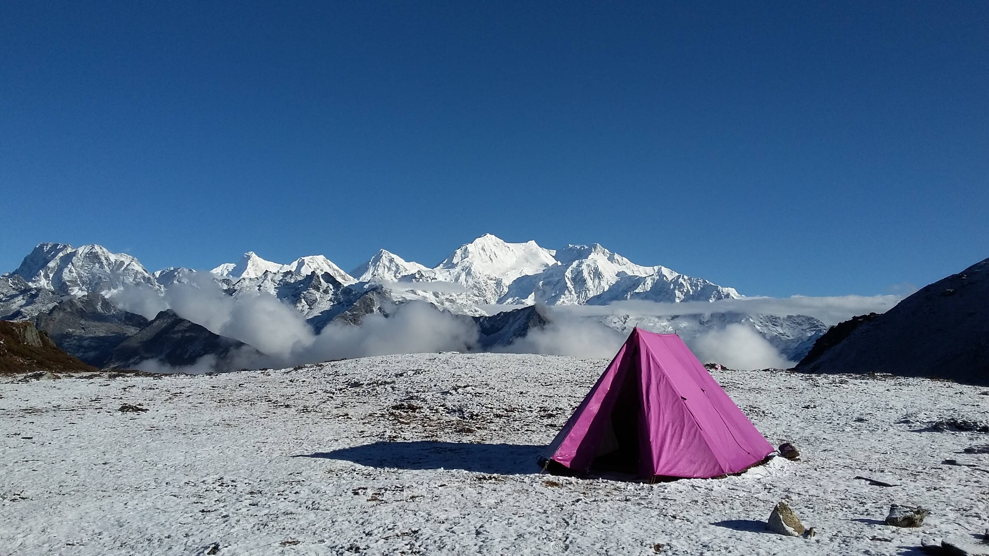
Uttarey Singalila trek starts from a small village Uttarey situated at the far western corner of Sikkim. The first-day journey traverses through the agricultural field and semi-tropical forest of Uttarey and after several hours of easy and gradual uphill hiking reaches the first campsite Chewabhanjyang at 3500m. Chewabhanjyang is the main border point and has a small security border camp. The next day takes a full rest day at Chewabhanjyang for proper acclimatization and morning excursion to the viewpoint for panoramic mountain views. From here on you will mostly be hiking on the alpine valleys for several days crossing high passes and ridges with magnificent viewpoints and diverse landscapes. Upon arrival at Dzongri camp after several days hike, we will take one more rest day for refueling the body, acclimatization, and excursion to the most magnificent viewpoint of the whole Trek “Dzongri Viewpoint” or “Dzongri La”. From Dzongri onwards you will be following the regular Goechala-Kanchenjunga trails till Goechala viewpoint and back to Yuksam.
Itinerary
- +
Day 1
Uttarey to Chiwa Bhanjyang (3200m/14 km/6-7 hrs) (Camping) - L/D
After breakfast head on for the first day Trek towards Singalila ridge. Today it’s a relatively easy trail which rises gently through rainforest until a final steep ascent for the last couple of hours bring us to the Nepalese border and our first camp. O/N at camping
- +
Day 2
Chiwa Bhanjyang Rest and Acclimatization (3200m/4-5 hrs) (Camping) - B/L/D
Take one day rest at Chiwa Bhanjyang. An important location for rest and acclimatization before heading up higher in the Himalayas for several days. Morning visit to a view point to enjoy the panoramic and spectacular views of the mountain range. Take a day hike around for stretching and acclimatization. O/N camping at Chiwa Bhanjyang.
- +
Day 3
Chiwa Bhanjyang to Ghairi (3600m/10 km/5-6 hrs) (Camping) - B/L/D
After breakfast trek towards Ghairi which is a relatively easy day hike with less height gain. Today it is mostly a trekking along a Nepalese border with glorious mountain views and pristine landscape. O/N at Ghairi
- +
Day 4
Ghairi to Dhor (3900m/9 km/5-6 hrs) (Camping) - B/L/D
A gentle uphill traverse through forest and then over a more exposed hillside brings us to prayer flags adorning our first pass and view of distant mountain - a taste of what is to come. As we gradually gain height, we will appreciate the previous day’s acclimatization. The occasional yak herder’s hut is the only sign of habitation as we look down far below to the rice fields and cardamom plantation. Our camp is in a remote and sheltered hollow below a ridge. O/N camping at Dhor
- +
Day 5
Dhor to Pare Megu (3800m/12km/6-7 hrs) (Camping) - B/L/D
Rising just before dawn, a five-minute walk onto the ridge may reveal the spectacular sight of sunrise on both Everest and Kanchendzonga. Throughout the day we descend and climb, maintaining a steady height, spiraling from one side of the ridge to the other until a rough steep ascent takes us across a pass. Beyond, the trail wends its way steadily through rhododendron and past several Hindu shrines where a second easier pass drop down to our camp close to a shepherd’s summer settlement. Look out for a blue sheep on the high craggy mountainside.O/N camping at Pare Megu
- +
Day 6
Pare Megu to Lam Pokhari (4100m/11km/4-5 hrs) (Camping) - B/L/D
We walk easily on a good trail through woods until we begin a steady rise up a broad valley where we catch our first closer view of the entire Kabru range dominated by mount Pandim (6691 m). A further two hours of ascent will get us to our camp with Everest and a host of other Khumbu giants dominating the distant skyline. An afternoon of rest and acclimatization for the following day’s foot slogging. O/N camping at Lam Pokhari
- +
Day 7
Lam Pokhari to Dafey Bhir (4500m) to Gomathang (3500m/9km/5-6 hrs) (Camping) - B/L/D
Now we are in the high mountain country and the forest lie far below. For the past two days we have been walking in Nepal and today we pass the sacred lake of Lam Pokhari, which marks our entry back into Sikkim. A little snow underfoot can be expected as we climb to our first pass, the Danphe Bhir La at 4530 m , the pass of the pheasant. From here it is possible to see the whole of Sikkim with the view stretching out well into Tibet and Bhutan. A further hour’s contouring and a small ascent reveals the Kag Bhir La -- the pass of the crow, where we may be lucky enough to view a panorama of Himalayan peaks including mt. Khanchendzonga. Reluctantly, we then must head downhill making a steep descent to our riverside camp. O/N camping at Gomathang.
- +
Day 8
Gomathang to Pangden (4100m/16 km/7-8 hrs) (Camping) - B/L/D
We leave our lovely meadow camp to climb through forests of sweet-smelling silver fir and rhododendrons. Soon we are in the high mountain terrain again. Look out for the brightly colored Danphe birds (impeyan pheasant), which nest in the high crags around the Khmasey La 4200 m. Further descend to the meadows of Kokling and hike for some period until we reach the Pangden camp site. O/N camping at Pangden.
- +
Day 9
Pangden to Dzongri (4030m/9km/5-6 hrs/) (Camping) - B/L/D
Today our route joins the regular trail up to Goecha La. A steady climb through ancient fir forest, juniper and rhododendrons gradually opens out to the summer pasture of Dzongri. Another high camp, but we should be well acclimatized by now probably in contrast to some of the trekkers we meet who could be on day 3 of their Dzongri trek at 4000 m. O/N at Camping at Dzongri.
- +
Day 10
Dzongri Rest – Aclimatization and Hiking Day (4030 – 4250m/4-6 hrs) (Camping) - B/L/D
Today we have to wake up early in the morning at around 4am and after some tea and biscuits head for DZONGRILA VIEW POINT to see the spectacular and panoramic view of mountain kanchendzonga and its neighboring peaks. The best view possible from goechala trek is from this view point. After taking your time for the scenery head back to camp sites. After breakfast hike towards laxmi pokhari and after lunch you can opt for HMI view point but it mostly depends on your choice and weather.O/N camping at Dzongri.
- +
Day 11
Dzongri to Thangsing (3930m/6 kms/5-6 hrs) (camping) - B/L/D
The day’s walk starts with a short climb to a ridge followed by a rapid steep descend of 100m to Kockchurung and Prek river. Continue crossing some boulders and climb gently to the campsite of Thangsing for our lunch with view of Mt. Pandim and Mt. Kanchenjunga.. O/N camping at Thangsing.
- +
Day 12
Thangsing to Lamune (4130m/6km/3-4 hrs) (camping) - B/L/D
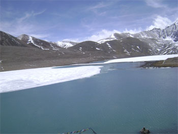
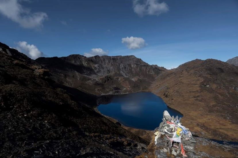
A gentle 2-3 hrs walk to camp at Lamune. While the camp is set up, we take a walk to Samiti Lake, 4453m with Kanchenjunga looming ahead of us. The trail goes past stunted rhododendron bushes, azaleas and past a prayer wall before ascending a moraine path to a ridge from where you can look down at Samiti Pokhari (4200m) a beautiful and sacred lake surrounded by snow capped peaks Mt. Kanchandzonga, Mt. Pandim and Mt. Thenchinkhang. Return to camp for lunch. O/N camping at Lamune
- +
Day 13
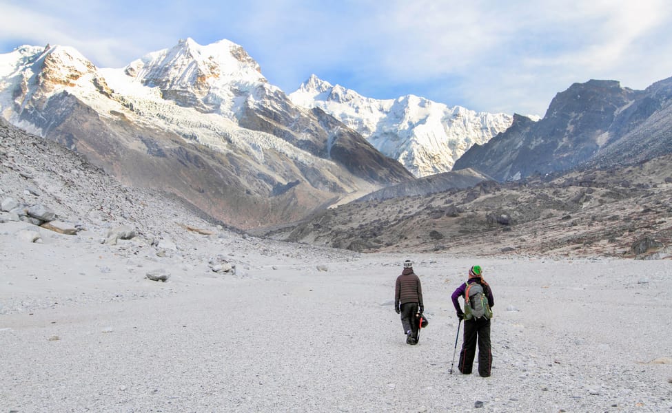
Lamune to Goechala (4940m/14km/5-6 hrs) / Thangsing (2 hrs) (camping) - B/L/D
Early morning excursion to Goechala (pass), one walk along the moraine path by the side of Samiti lake to view the east face of Mt. Kanchendzonga bathed in the rays of the early sun. We cross the ½ km sandy plain known as Zemathang, footprints of Bluesheeps and other animals are common sighting. After 2 hours, we arrive at the 1st view point of Goechala and walk further 2 hours to 2nd view point to enjoy the close up views of Mt. Kanchendzonga 8534m. Return to camp for late lunch and later walk to Thangshing campsite or Kockchurung campsite some 30 minutes below. O/N camping at Thangsing.
- +
Day 14
Thangsing to Kockchurung to Tsokha (3050m/14km/6-7 hrs) (Camping) - B/L/D
After breakfast, trek back the same trail till Kockchurung, from where we take another trail via Phedang to Tshoka. Hot lunch at Phedang and continue to walk to Tshoka. O/N in private lodge.
- +
Day 15
Tshoka to Yuksam (1785m/16km/6 hrs) (Hotel Stay)
Today the trail again goes down all the way to Yuksam via Bakhim and Sachen camp site. The trails goes down from Tropical to Semi Tropical Forest which is a home to varieties of Wild Flora and Fauna. The sighting of Animals is rare due to uneven and dense forest landscape - though this whole forest is a part of a famous Kanchendzonga National Park! One will be crossing three Hanging Bridges - Prek chu, Paha Khola and Tshushey - between Bakhim and Yuksam. Evening free to explore Yuksam.
Trip Highlights
The highlight of the trip is as follow -
1) Yuksam - The first capital of Sikkim and a base camp of famous Goechala Kanchendzonga Trek and several Mountain Expeditions. The Oldest monastery of Sikkim, Dubdi Monastery is located at Yuksam. The Famous Coronation Throne where the first king of Sikkim was crowned by the three religious monks is in Yuksam.
2) Tshoka - A small Refuge settlement at the height of 3000m. A first-day camping point of the trek. From Tshoka one can see a glimpse of towering snow-capped mountain peaks - Mt. Pandim and few others.
3) Dzongri Viewpoint - The most beautiful and ideal viewpoint of high-altitude treks in Sikkim. One can witness a 360-degree view of the Pristine and Panoramic 16 snow-capped mountain peaks and hills. Located at the height of 4250m Dzongri Viewpoint offers sublime and capitative scenery of the entire Himalayan range...
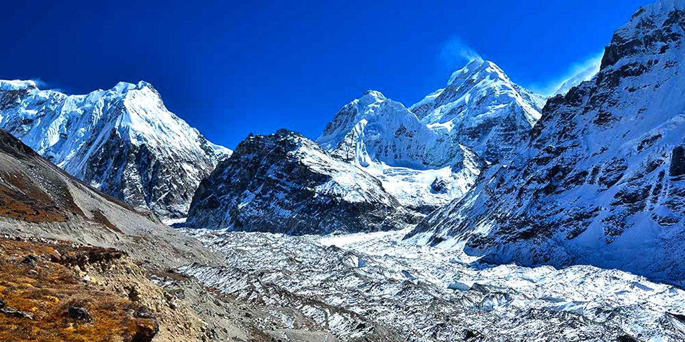
4) Goechala Viewpoint - The closest point to Mt. Kanchendzonga - The guardian deity of Sikkim! The goechala viewpoint provides a sublime and closest view of Mt. Kanchendzonga and Mt. Pandim. One can have the closest look at Thalung Glacier too at the bottom of Mt. Kanchendzonga.
5) Samiti lake - One of the most pristine and holy high-altitude lakes in Sikkim. It lies exactly Infront of Mt. Kanchendzonga and is a treat to witness on a clear sunny day.
6) Laxmi Pokhari (Lake) in Dzongri - A pristine high-altitude lake situated 3 hours walk from the Dzongri Campsite
7) Dafey Bhir - A spectacular viewpoint from where you can see Mt. Everest, Mt. Lhotse, Mt. Makalu of Nepal, and Mt. Kanchendzonga, Mt Pandim, and other peaks of Sikkim.
8) Uttarey – A beautiful village located at the border between Sikkim, INDIA, and Nepal. It is also a base camp to Singalila Ridge Trek
9) Gomathang – A beautiful alpine valley camping site with mesmerizing landscape and scenery.
10) Pangding – A beautiful campsite at the bottom of a big high mountain hill adjoining the Dzongri Goechala range
Health and Fitness
You have to be Relatively Fit and Healthy to undertake the Uttarey Singalila trek. Trekking for 6 to 8 hours a day is one of the most important requirements for this high-altitude trek. Apart from good health condition basic mental preparation is also very important to undertake this Trek.
People suffering from Acute Heart and Lung diseases, Asthma, and High blood pressure are not recommended to take up this trek.
To complete this high-altitude trek regular exercises like running, skipping, aerobics, Zumba, and long-distance uphill trekking (4 to 5 times a week) are highly recommended. One should start making basic physical preparation at least a month before a trek. These exercises help you during the Trek.
The packing of right and comfortable clothing also makes a difference in the completion of Trek, so it is necessary to be disciplined while packing your clothing for the trip. You can contact us for help with clothing choice and packing!
During the Trek, we provide a basic medicine Kit which includes Medicine for High Altitude sickness, Headache, Diarrhoea, Vomiting, Common Cold, etc. All of our medicine is scientific medicine purchased in India, however, we advised you to bring your small medicinal kit for the trip if possible.
Trekking/Tour Tips
1. A common tendency among young blood and beginners is to show enthusiasm by walking fast with excitement. Even the experienced sometimes try to show off by walking fast, this is soon exhausting and not recommended. Walk slow - warm up gradually and continue at a slow comfortable pace before pushing yourself a little more.
2. Develop a personal rhythm. Maintain your steps to synchronized with breathing. This will help minimize getting out of breath.
3. Walking in Himalayan trails with loose soil and rocks is tricky. So, avoid stepping on loose soil and rocks and place the foot flat and firm with a better grip. Always follow the rule ‘heel first’ while walking in the Himalaya trail.
4. Walking in a zigzags manner while ascending on a very steep slope is advisable. While descending walking zigzag is a good technique to avoid excessive pressure on knees and avoid knee pain and blisters.
5. Avoid stepping on loose stones and soil to avoid an accident.
6. Avoid overtaking fellow travelers on a narrow trail. Only Overtake at comfortable wide space if necessary.
7. While ascending and descending a slope or over loose stones, leave sufficient space between the next person so that any stone rolling down does not hit trekkers below.
8. Do not run down a slope. Bend knees a little while descending. Dig heels into soft snow or soft ground.
9. Our Himalayan condition is mostly wet so avoid wet grass, wet roots, and the muddy zone which can be very slippery. Be careful while walking on them.
10. Shortcuts on a foot trail should be avoided.
11. Always put-on warm clothing while taking a rest. This will help avoid getting cold, cough and high-altitude sickness
12. Respect the sentiments and traditions of the local hill people.
13. Always carry enough water in your water bottle as water is essential in avoiding altitude sickness.
14. Wear a comfortable and right set of trekking boots, pants, and jackets. Avoid wearing new trekking boots directly for the Trek. Get used to it by wearing it before the trek. Carry all necessary clothing.
Halts and Rests:
1. While taking a rest, lie against a tree trunk, a big stone, or on flat ground. Place your legs on your bags or any other higher ground. This helps regulate blood circulation.
2. Stop at any comfortable point after the first start to readjust your rucksack, jackets, or to tie a shoelace for better comfort and adjustment.
3. Do not make frequent or prolonged halts. Too many small stops destroy the walking rhythm. Frequent rests are not helpful. You should follow your own rhythmic walking pace and technique to avoid unnecessary tiredness. A stop should be made only at natural stopping points, like on the top of a ridge, or before an ascent, or at a scenic viewpoint.
4. Stop and place yourself on the safer (Mountain) side to give way for the pack animals to pass through. Avoid bags carried by the animals that can push you. Be aware of the yak's horn too.
SERVICES INCLUDED:
1) HIGH ALTITUDE TREKKING PERMITS/PERMISSION
2) LOCAL ENGLISH SPEAKING GUIDE
3) EXPERIENCED LOCAL COOK
4) LOCAL PORTERS
5) PACK ANIMALS
6) 2 MEN TENTS / HUTS
7) KITCHEN & DINING TENTS
8) SLEEPING BAGS
9) MATTRESSES
10) HOT WATER BAGS
11) NATIONAL PARK FEES AND PERMISSION
12) TOURISM FEES AND PERMISSION
13) ENVIRONMENTAL FEES
14) ALL MEALS AND DRINKS THROUGHOUT THE TREK
15) TABLE & CHAIR
16) BASIC MEDICINAL KITS
SERVICES EXCLUDED:
1) INTERNATIONAL AND DOMESTIC FLIGHT TICKETS
2) TRANSPORTATION TO / FRO STARTING & ENDING LOCATION
3) INSURANCE OF ANY NATURE
4) ALCOHOL AND BEVERAGES
5) TIPS AND GIFTS
6) PERSONAL SHOPPING COST
7) ANYTHING NOT INCLUDED IN INCLUDED LIST
FAQ (Frequently Asked Questions)
HOW TO REACH UTTAREY / YUKSAM?
The closest Airport to Uttarey and Yuksam, Sikkim is PAKYONG AIRPORT & BAGDOGRA AIRPORT. You have to fly either to Bagdogra Airport or Pakyong Airport. From there you can drive to Nambu / Yuksam with a private reserve vehicle.
Pakyong Airport is around 6 to 7 hours’ drive and Bagdogra Airport is around 7 to 8 hours’ drive from both Uttarey and Yuksam.
WHAT GEARS AND CLOTHING TO CARRY FOR UTTAREY SINGALILA TREK?
No matter what season you are planning for the mountains are always going to be cold, rough, and tough so it is absolutely necessary to pack yourself with adequate and proper clothing. Here is the standard kit checklist for the Trek.
Proper packing of the trekking gears is absolutely necessary with eyes on the weight limit. It is important to have a good brand of clothing.
Basic Gears:
Back Pack & rain cover or Duffel bag (50 to 70 ltr)
Day Pack & rain cover (20 to 30 ltr)
Walking stick (1 pair or at least one)
Water Bottle (2 bottles of 2 ltr each)
Thermos flask (1 nos)
Head Light (1 Nos with 4 pairs of batteries)
Gaiters (1 pair)
Upper and Lower Clothings:
T - Shirt (2 to 3 full sleeves). Mostly noncotton
Fleece T-shirt (1 nos)
Thermal Inner-wears or base layers (1 nos or 1 pair) such as long jones
Fleece Jacket (1 nos)
Down, Feather, or Holofil Jackets (1 nos)
Wind and Waterproof jackets & pants (1 pair)
Trekking Pants (1 pair). Comfortable and durable
Short Trekking Pants (1 nos or 1 pair)
Poncho (1 nos)
Headgears:
Woolen cap (1 nos)
Sun cap (1 nos)
Balaclava or scarf (1 nos)
Sunglasses (1 nos) U/V protected and dark
Hand gears:
Waterproof gloves (1 nos)
Woolen gloves (1 nos)
Feet gears:
Waterproof Trekking boots (1 nos) preferably ankle high Goretex, North face, Colombia or Quechua
Snickers or running shoes (1 nos) preferably from any reputed brand
Gaiters (1 nos)
Sandals or flippers (1 nos)
Cotton socks (4 pairs)
Woolen socks (2 pairs)
Personal utilities:
Sunscreen cream
Moisturizers
Hand sanitizers
Toilet papers and wipes
Anti-bacterial powders
Lip balm
Toothbrush and toothpaste
Proper packing of the trekking gears is absolutely necessary with eyes on the weight limit. It is important to have a good brand of clothing.
CAN I EXIT YUKSAM ON THE LAST DAY OF THE TREK DIRECTLY?
Yes, you can if you are looking to reach any other location near to Yuksam OR if it is too urgent and necessary. Driving to Airport and Railway directly after the trek is not recommended.
We will advise not to plan to leave Yuksam directly after the last day of Trek as it will be too tiring and hectic. Driving at night on the Himalayan road is not comfortable and enjoyable.
The earliest you will reach Yuksam on the last day of the trek is around 1 pm so long hours drive thereafter is not possible.
CAN I LEAVE EXTRA BAGS AT UTTAREY / YUKSAM AND COLLECT THEM ON THE LAST DAY OF THE TREK?
Yes, you can leave a bag of clothes with our office staff before the start of the trek at Uttarey and collect it after the trek. In fact, we will advise you to leave one set of clothing for the last day as normally pack animals arrive late on the last day of the trek.
You can even keep valuables and cash at our office safely and collect them after the trek.
WHAT DOCUMENTS NEED TO BE CARRIED?
It is mandatory for Indian trekkers to carry identification documents such as VOTER ID CARRD, DRIVING LICENSE, AADHAR CARD, INDIAN PASSPORT. Original documents need to be carried along with 4 pcs PASSPORT SIZE photograph.
Foreigners need to carry INDIAN VISA, PASSPORT & SIKKIM INNER LINE PERMIT along with 4 pcs PASSPORT SIZE photographs.
A medical fitness certificate is also mandatory however this can also be arranged at Yuksam in case you are not able to bring it.
IS THERE CONNECTIVITY DURING THE TREK?
There is no phone connectivity during the Uttarey Singalila trek. Uttarey, Chewabhanjyang, and Yuksam is the last village where you can get a phone and internet connection.
At certain specific locations between Uttarey to Chweabhanjyang, Dzongri, Phedang, and Tshoka, you can get Vodafone, Airtel, and Jio networks. Network largely depends on weather conditions of the given period.
There is no electricity throughout the Uttarey Singalila trek.
HOW IS THE WEATHER & TEMPERATURE DURING THE TREK?
There are two distinct seasons for doing Uttarey Singalila Trek. Mid-March, April to May (Spring) and Mid-September, October to November (Autumn). Normally weather remains good and clear in those given periods however there is no guarantee as weather is extremely unpredictable in our Himalayas and does change within hours and days.
The temperature at each campsite depends largely on each day's specific weather condition.
Spring (Mid-March, April till May)
* Yuksam to Tshoka / Uttarey to Chewabhanjyang
Morning and Evening – 12 to 16 degrees centigrade
Day time – 18 to 24 degrees centigrade
Late Evening and Mid Night – 8 to 14 degrees centigrade
* Phedang, Dzongri, and above / Dhor to Parey Megu and above
Morning and Evening – 4 to 12
Day time – 12 to 18 degrees centigrade
Late Evening and Mid Night – minus 10 to 4 degrees centigrade
Autumn (Mid-September, October till November)
* Yuksam to Tshoka / Uttarey to Chewabhanjyang
Morning and Evening – 8 to 14 degrees centigrade
Day time – 16 to 21 degrees centigrade
Late Evening and Mid Night – 2 to 10 degrees centigrade
* Phedang, Dzongri, and above / Dhor to Parey Megu and above
Morning and Evening – minus 8 to 10
Day time – 2 to 14 degrees centigrade
Late Evening and Mid Night – minus 15 to 2 degrees centigrade
 Call now -